
Harbour, beach & town
Whangamatā town map
A local view of our streets, reserves and coastline, from the supplied WBA visitor map.
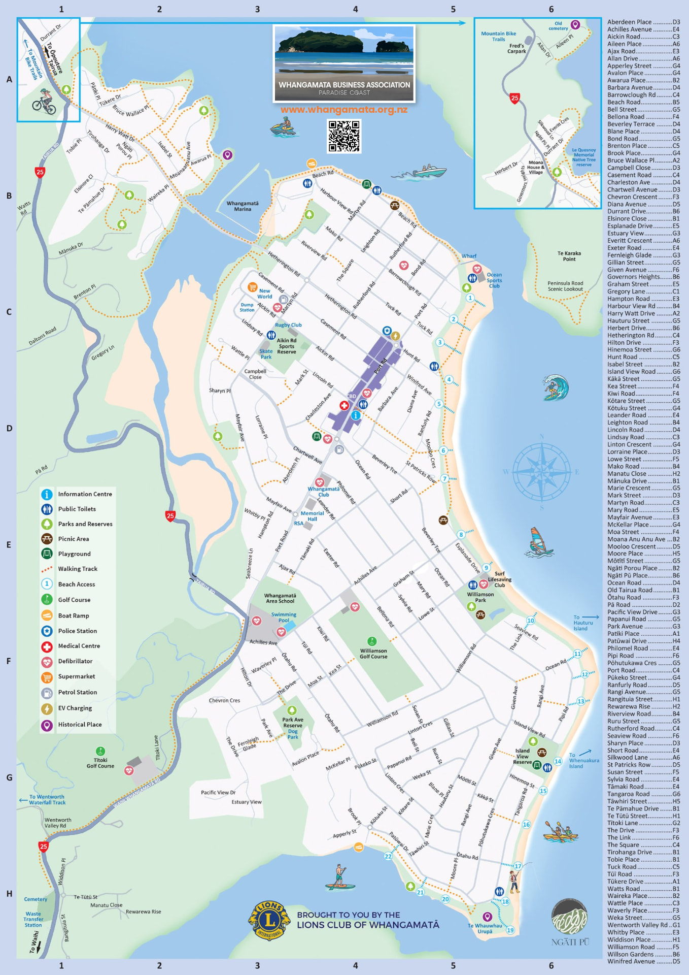
The original artwork includes beach access numbers, public toilets, playgrounds and other symbols. Printed WBA, Lions Club and Ngāti Pū credits remain intact.
Find a street
129 streets
Places on the map
Information Centre
Information Centre symbol on the town map, near the town centre.
Map symbols show what is printed on the supplied guide; facilities and current access have not been independently verified.